Ding and Dang Canyons are non-technical slots canyons west
of the more popular Bell and Wildhorse Canyons near Goblin Valley State Park.

The trailhead is only about a mile west of the Wildhorse
trailhead parking. Depending on road conditions, most vehicles can make the
drive to Ding and Dang, but the road is much more rugged once you pass the Wildhorse
parking area.
I’ve never traveled this area in anything but a high
clearance 4X4 vehicle and caution and care should be taken when driving in the
backcountry in a regular passenger vehicle.
All my posts are for informational purposes only and each
person must accept their own responsibility for potential challenges associated
with outdoor activities.
As a note: Within days of doing this hike, two children were
killed in a flash flood in Wildhorse Canyon. Weather is a major factor in accessing
the dangers of hiking the canyons in the desert southwest.
After parking at the Ding and Dang trailhead, the route
follows the open canyon to the west until the drainages merge. To the left is
Dang and to the right is Ding.

I like to hike in a counter-clockwise direction
as I find it easier to descend the higher drops of Dang Canyon and ascend the
shorter climbs in Ding Canyon.
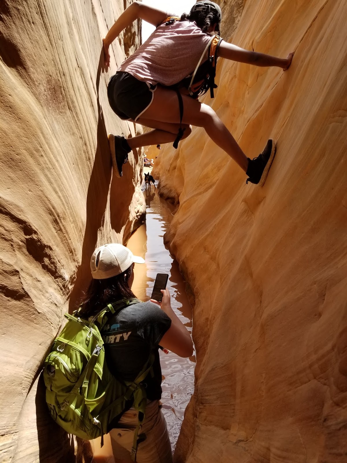
No matter what direction you choose to go, there are plenty
of boulder chokes, climbs and descents to work through. This is a more
technical hike than Wildhorse, and the BLM recommends being prepared with technical
gear. We brought rope but ended up using the ropes already in place at each
descent in Dang Canyon.

Plan on standing water in the canyons, especially in Dang
Canyon. We managed to keep our feet dry until one of the last sections of Dang
Canyon. If you are willing to shimmy your way through the wet sections, it’s
often possible to stay dry. I didn’t want to work that hard and had planned on
wet feet anyway.

When Ding Canyon starts to open up, pay attention to the
pointed butte to the west called Ding Dang Dome. This is the direction to hike
to access Dang Canyon for the return trip through the swell.
There is more than one trail as you work your way towards the
butte and we chose to stay to the left (southwest direction) and found that this
trail was shorter than the alternative that went right (northwest direction.)

Once past Ding Dang Dome the return canyon, Dang, comes into
view.

It doesn’t take long before longer and steeper drops become
more common. In every case, rope or webbing was already placed at each drop,
but it’s best to bring your own rope just in case.
Enough upper body strength to control your ascent for each
drop is a must as the drops are significantly longer than those found in Ding
Canyon. Hence, the preference to descend Dang Canyon.

This is where the BLM recommending technical
gear to make the descents safely.

The last major obstacle in Dang Canyon is the section with
the highest probability of getting wet feet. It is narrow enough that someone shimmying
could keep dry, but it is a long section to shimmy before the water is
completely avoided.
Once the slot canyon opens up, it still takes some time and
distance to reach the confluence with Ding Canyon and you reach the trailhead
parking area.

Additional Photos:


