Even though I have explored many places in the Grand
Staircase National Monument like Coyote Gulch more than a dozen times, I had not
had the experience of hiking Buckskin Gulch or the Paria River area until this
last summer, June 2019.
I had heard of Buckskin Gulch quite a few times, but very
little about the Paria River. Other than the Paria was usually the reason why
the Colorado River when from clear to cloudy water on my Grand Canyon rafting
trips.

When a friend got his hiking permit for both Buckskin and
the Paria and I got the invite to join his group, I was really excited to do
Buckskin Gulch knowing it would be a long narrow canyon hike. I imagined the Paria to be a very wide open
and exposed canyon and wondered if hiking the Paria was going to be worth it.
Our trip was in late June to have a better chance of good
weather for the 5 day trip.
We were scheduled to start the hike on Tuesday, but the
weather in the Bryce Canyon area was threatening.
We stopped by the Paria Ranger Station east of Kanab on
Monday afternoon to check in and get the permit. Checking the weather forecast
one more time, we decided to wait a day and hike Buckskin Gulch starting in
Wire Pass on Wednesday.
We had already planned to check out Horseshoe Bend and
Antelope Canyon near Page, AZ on Monday before starting the hike.


After enjoying the rest of the day near Page, we then worked
our way back up Hwy 89 and found excellent camping at the White House
Campground.

Due to the weather issues, we decided spend Tuesday out on
the North Rim of Grand Canyon as a worthy alternative.
After spending the night at White House our group of six
enjoyed the North Rim of Grand Canyon on Tuesday being auto tourists taking in
the sights available to people who take the short walks to the various
overlooks along the north rim.

Being a long-time whitewater rafter, it was fun to look down
from the north rim and look at a rapid in the distance and recognize the rapid
as Unkar. That’s a long way up the canyon rim to scout a rapid! At least from
that vantage point it sure liked Unkar to me.

After leaving a vehicle at Lees Ferry for a way back after
completing the hike, we drove north on House Rock Valley Road (BLM 1065) to
Stateline Camp to be close to the Wire Pass trail head the next morning. It’s
approximately 34 miles from Lees Ferry to House Rock Valley Road and 19 miles
north to State Line. This camp has vault toilets, canopies, and picnic tables,
but no water.

Wednesday we were greeted with great weather and we packed
up and headed to Wire Pass, just two miles north of the State Line Camp.
Many who hike Buckskin in one day will hike in through Wire
Pass and head one-way through Buckskin and then turn upriver on the Paria to
White House to complete the long day hike.
The Wire Pass trail head has a large parking area and vault
toilets, but no water. The trail starts across the road heading east into the
wash. Because we were carrying full backpacks we chose to access Buckskin Gulch
via Wire Pass to cut off a few miles.

Wire Pass is 1.7 miles in length. Starting the hike where
the road crosses Buckskin Gulch is 4.5 miles to the Wire Pass Junction
decreasing the first day’s mileage by almost 3 miles.
Wire Pass starts out wide and eventually narrows down to a
nice slot canyon, similar to what is found in Buckskin Gulch. Wire Pass is also
a popular access point to Coyote Buttes, better known as The Wave.
Wire Pass has a boulder choke that isn’t too difficult to
negotiate.

Wire Pass also gets narrow when carrying a full pack, but
nothing very difficult.

The junction of Wire Pass and Buckskin Gulch has some faint
petroglyphs on the right side of the canyon wall.

The length of Buckskin Gulch from Wire Pass to the
confluence with Paria River is approximately 11.5 miles. This is a canyon NOT
to plan on camping in as the flash flood danger is extreme so completing the
Wire Pass to the Paria section of 13 miles is a must.
Using a map that starts at the Buckskin entrance, mileage at
the confluence would be 4.5 even though the Wire Pass entrance cuts off 2.8
miles. Each time a mile point is identified, subtract 2.8 miles to get the
actual mileage hiked from the Wire Pass trail head.
Buckskin Gulch tends to alternate between relatively narrow
sections to wider open sections, but it’s safe to say emergency exits to high
ground are few and camping options do not exits, even in the wider places.

What struck me as usually compared to all the hiking I have
done in the region is the moss growing on the walls because the sun never
reaches those areas because the canyon is so deep and narrow in places.

Being inclined to simply soak in the beauty of the area, I
didn’t take a lot of pictures.
Keeping in mind the canyon stretches for over 11 miles after
reaching the confluence from Wire Pass, the changes in the character of the
canyon were very interesting.
The person with the permit was experiencing his third trip
through Buckskin/Paria and he was very surprised at the amount of water in
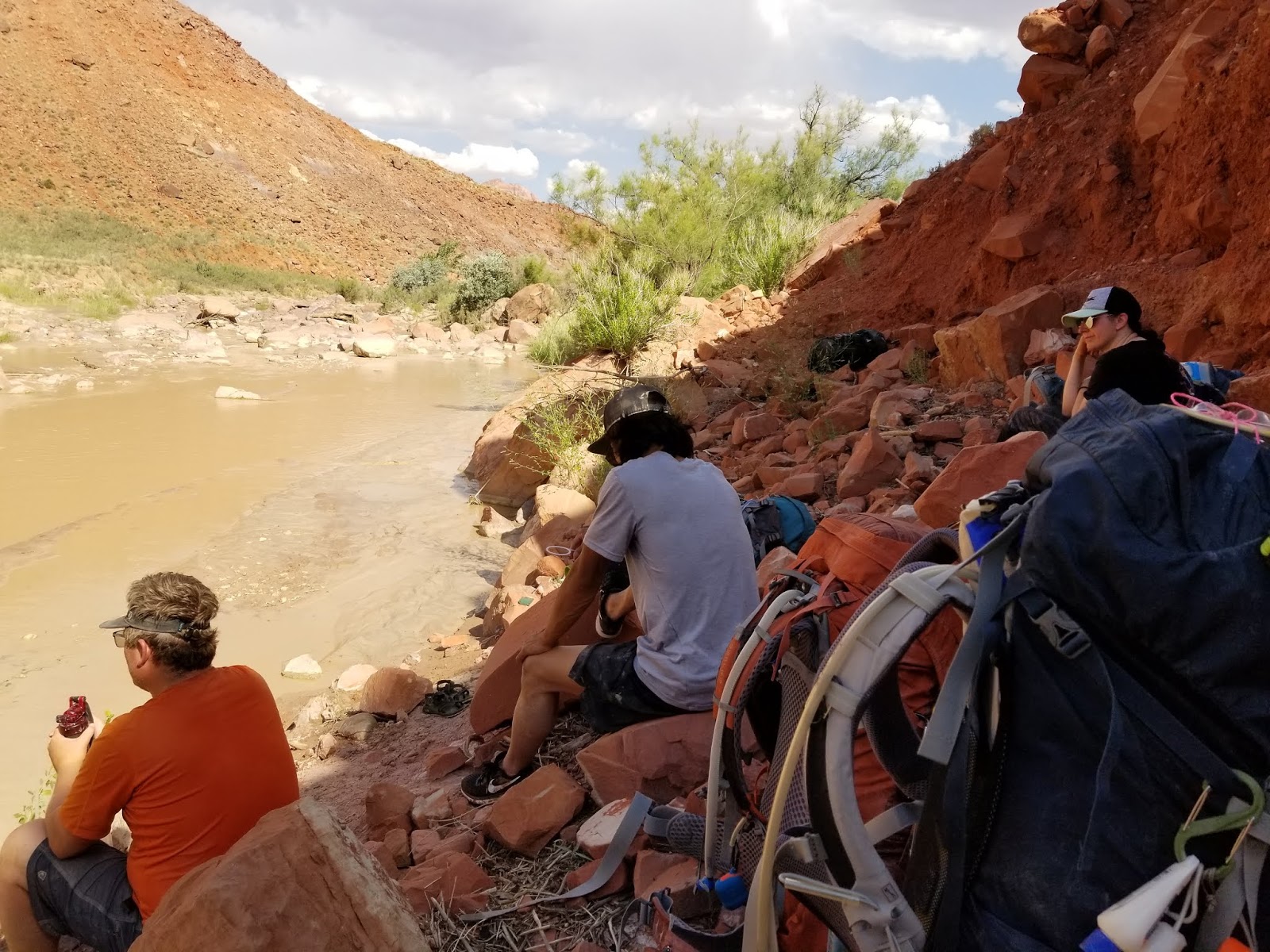
Buckskin.

We were in water and mud for a significant portion of the
day.
After a while we stopped worrying about the bottom of the
pack touching water as it was just took too much effort to keep the pack up
higher than the water line.
There were a couple of boulder jams that took some effort to
negotiate.

The first one had a relatively easy route up and over the
left side of the canyon. I wasn’t able to determine where in the canyon we
reached this first boulder jam to identify the mileage point.
The “Middle Route” at Mile 11.5 wasn’t obvious to me. I took
a couple of pictures wondering if that spot might be the Middle Route out of
the canyon, but I was never very confident that we had found it.

The big major boulder jam at Mile 14.5 was very obvious.

It took us a little while to find a viable way through the boulder jam as standing water had clogged up a lot of the areas that could have
served as a passage way down.

The common route of scaling a boulder with toe holds carved
into the rock just wasn’t working out as an option as wet boots were just not
gripping the toe holds consistently enough to risk it.

We found an alternate sliding down a sloped rock and in to
an open area below the largest boulders.
We lowered the packs down approximately 20 feet and then we
were able to continue hiking beyond the big jam.

Approximately a ¼ mile from the confluency with the Paria
the canyon opened up with some potential camping.
One thing I noticed was a little bit of clear water coming
in from the right side near where a camp was indicated on the map.

We didn’t stop, but I suspect there was a good possibility
of a fresh water spring near that camp.
After reaching the confluence with the Paria River, we
headed downstream for the rest of our hike.
The confluence of Buckskin and the Paria is about ¼ mile
past Mile 7 on the Paria River. Keep in mind we
had already hiked 13 miles even though the map mileage at this point is
only 7.
Another group had already set up camp on river left not very
far downstream from the confluence, so we kept going approximately 2 more miles
to a nice high camp on river right.

The water was very silty and we used a collapsible water
bucket to settle water for the rest of our water needs in camp and for the
first part of the next day.
On our second day we stopped for water at a wall spring that
wasn’t producing a lot of water. We put water bottles below the best flowing
“drips” and relaxed for about 45 minutes while we waited for our bottles to
fill.

When we came to Big Spring just past Paria River Mile 12, we
found a excellent flowing spring in the rock and quickly filled all our
containers.

In the future, I plan to not spend much time at the first
spring unless it’s flowing well, anticipating that Big Spring will be flowing
well.
Because we dropped a day in favor of drier weather, we
needed to average around 10 miles a day or more to reach Lees Ferry on Saturday
early enough to be able to travel back to Salt Lake City by Saturday night.

We left Big Spring all topped off with water and continued
to a nice high camp near Wrather Arch Canyon on river left.

We were never quite sure where Wrather Arch Canyon came in. We
may have passed it prior to camping, but either way we didn’t hike up the side
canyon to see Wrather Arch.
We almost missed Shower Spring as it’s hidden behind a lot
of growth at Paria Mile 22.

Luckily there was a group of scouts from Arizona who were just
getting ready to leave and pointed out where to access Shower Spring. The area
opposite Shower Spring looked like an excellent camp option.
Shower Spring was nice and cool and almost felt tropical. We
topped everything again and headed down the river again.
Because the water was very silted and higher than typical
for June, finding river crossings and the best routes weren’t as easy as other
times according to our permit holder.

We met up with the scout troop near Mile 25 and we were a
bit surprised they had already stopped.
We realized later that they had stopped to refill at what is
labeled on the map as the last reliable spring. We totally missed the
opportunity to top off one more time.
We eventually started accessing the high-water trail, which
was a much better option than the numerous river crossings that would have been
required had we stayed low.

Personally, I enjoyed the Paria River portion of the hike
more than Buckskin Gulch. We all have our preferences, and I had expected the
Paria to be a wide-open canyon most of the way.

I was pleasantly surprised to be able to experience many
dramatic changes in the scenery and character of the canyon and loved every
step.
After the wide trail descended to a river crossing, we
decided to stop and filter water just in case we ended up on the high trail
longer than our water would have lasted.
Because the water was so silty, it took a long time to
filter enough water to ensure everyone had at least a quart to hopefully get us
to our final campsite.
I personally only carry a water filter that has a ceramic
filter. A paper filter would have clogged on the first day and would have been
useless at that point. Ceramic filters do clog faster but can be cleaned many
times over without the filter failing.
I’ve had a Katadyn Pocket for more than 10 years and have
filtered a lot of silty water and I’m still on the original ceramic filter.
If I were hiking near high-mountain clear streams it would
be a big deal to have something like a Katadyn Pro with a paper filter system.
In the canyons where cloudy water is the rule, not the exception, a ceramic
filter is well worth the extra cost.
Our goal was to reach Mile 33.5 next to Wilson Ranch.
At Mile 31.5 we crossed to river left and came to a few
boulders full of petroglyphs.

As we were looking at one boulder in particular, we were
surprised to see a triangle shaped shadow stretching across the petroglyphs.

Someone also realized that it was 6pm Mountain Time on June
20th, the summer solstice. This may be totally coincidental, but
looking at the way the shadow spread across the rock and being later in the
day, how maybe earlier the point of the shadow could have pointed to the spiral
design on the rock, I couldn’t help but think of the Sun Dagger petroglyph at
Chaco Canyon that marked the solstices twice a year. A pretty cool possibility
to consider!

Hopefully, we’re past the days when people think it’s okay
to deface ancient artifacts with their own stupid initials or names like
“Elick.” Ugh!

After a long day we finally made to Wilson Ranch only to
realize the scouts were already there. Not knowing what possible camps were
ahead of us that were close to the river, we asked if they wouldn’t mind if we
camped down below them about 50 feet. They were gracious enough to let us camp
close by.

We had a very windy night, but everyone was tired enough
that we all slept well.
Because we made it all the way to Wilson Ranch on Day 3 we
only had 5.5 miles to reach Lees Ferry.
By now the canyon had widened out much like what I had originally
expected the entire Paria hike to be like.
The closer we got to Lees Ferry, the more evidence of
civilization we would see.

There was road construction happening accessing Lonely Dell
and we had to park our vehicle where the river runners would park. This also
meant we had to cross the Paria one more time to reach our destination without
having to take a huge detour west to the paved road and then back up to the
Lees Ferry parking lot.

I’m probably in the minority with my thoughts about the Buckskin/Paria
hike. I really enjoyed hiking Buckskin, but I absolutely loved hiking the
Paria.
The upper section was reminiscent of Coyote Gulch in some
ways, with the middle section changing to something more unique, and then
opening up to grand vistas of some of the larger canyons in Grand Canyon.
I’m already anxious to set up the
next trip down the Paria, and if it includes Buckskin Gulch as well, I’ll be
just fine with that too!
No comments:
Post a Comment